The Heron’s Arctic Adventure
2006
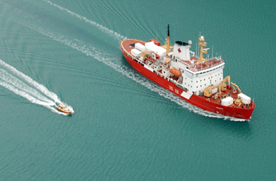
UNB’s premier research vessel, the CLS Heron, made a
successful trip to the Canadian Arctic this year hitching a ride on the side of
the CCGS Amundsen, Canada’s
100 metre research icebreaker. The Amundsen left port in Quebec City on August 22nd, 2006 and will return on November 10th, 2006.
The trip is divided into two six week legs. Steve Brucker, Ian Church, Jonathan
Beaudoin (last four weeks of leg) and John Hughes Clarke (first two weeks of
leg) manned the first leg of a journey though the Northwest Passage ending in Kugluktuk, Nunavut. Jason
Bartlett, Doug Cartwright and Pim Kuus are currently enjoying the second leg
which started in Kugluktuk, went into the Beaufort
Sea and they are now returning through the
Northwest Passage.
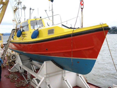
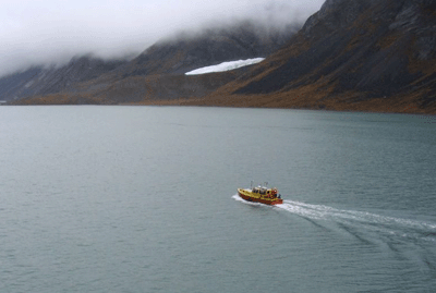
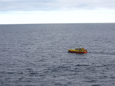
Heron
on the side of the Amundsen (Church, 2006)
The
Arctic
mapping family in Oliver Sound (McFadden, 2006)
After sitting
idly by for 12 days, it was the Heron’s turn to shine for the Oliver Sound survey.
Oliver Sound in located in Sirmilik National Park on the northern tip of Baffin
Island. The purpose of the Oliver Sound survey
was to map the deep sections of the uncharted fjord with the Amundsen and to
map the glacier fronts and shallow waters with the Heron. To keep things
exciting, the Heron was launched for the first time in the middle of the night.
Over approximately 24 hours, Oliver Sound and one side fjord were mapped.
Launching
the Heron in Oliver Sound (Church, 2006)
The
Heron surveying in Oliver Sound (Church, 2006)
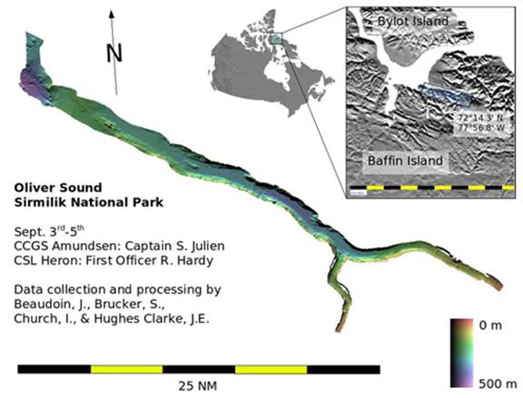
Oliver Sound Survey
Map
The
next stop for the Heron was the scenic Belcher Glacier on Devon Island. For this survey,
the Heron’s job was to map the glacier front while the Amundsen mapped the
uncharted waters in the inlet. Over 12 hours the majority of the front of
Belcher Glacier was mapped with the Heron, while the surrounding waters were
mapped by the Amundsen.
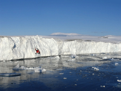
Belcher
Glacier (Church, 2006)
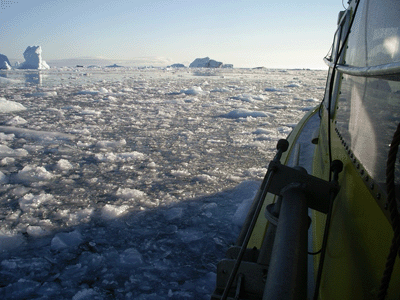
A
view from the Heron (Brucker, 2006)
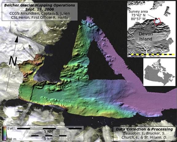
Belcher
Glacier Survey Map
The
third stop for the Heron was Resolute
Bay, Nunavut. Over the 12 hours allocated for this survey, the Heron mapped the
near shore waters of Resolute while the Amundsen sat at anchor for a community
visit.
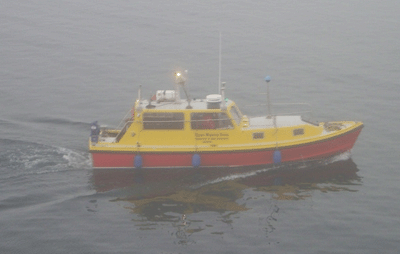
The
Heron heading out into the Resolute Bay fog (Brucker, 2006)
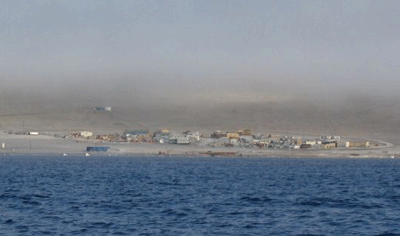
The
northern community of Resolute Bay, Nunavut (Church, 2006)
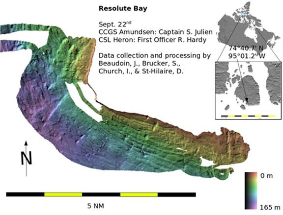
Resolute
Bay Survey Map
The
fourth and final Heron survey for leg 1 was in Coronation Gulf. The
Heron and the Amundsen both contributed to mapping along a potential new
shipping route in the southern section of Coronation Gulf. The
Heron spent its time in the shallow waters along a line of outcropping bedrock
escarpments while the Amundsen mapped the deep basins along the potential
shipping route.
The
Heron heading out to survey in Coronation Gulf (Church, 2006)
Leg
two proceeded to perform a number of Heron surveys in the Beaufort Sea region. More
information and pretty maps will be available when the crew from leg two arrive
back at UNB.