rover folder (= Heron)
base folder (= base station)
-
Process trimble data
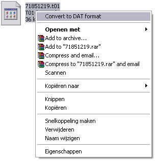
-Right click on .t01 file
-Convert to .dat format
This works when you installed the software for the base station - GPS configurator, you can either get it from the CD provided by the GPS or download it from internet
-
Process CNAV data
-
Copy rinex.exe into the cnav folder
-
Rename the file to a name with only small caps, no numbers, signs or capital letters
-
Go to start/run, open:cmd
-
In commandline go to the cnav folder
-
Type: rinex –i: filename (without .dat)
-
-
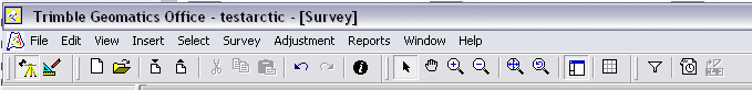
open Trimble Geomatics Office
-new project (example: 29April2008)
-use metric as template
-ok
-auke/TGO/processed.
-project properties, ok
-import .dat file (base station data)
-now you can give it the northing and easting of the bench mark (when you don't have those you can obtain them from OPUS, http://www.ngs.noaa.gov/OPUS/)
- Open
-Ok
-Ok
When you have more .dat files select all the files in the folder of that day, make sure you change them in the same name after pressing ok.
-import rinex file
Auke/tgo/raw/date/cnav
Open
Ok
Ok
-open time line
Click at the + sign CNAV data
Right click at blue bar which is totally down
Properties
Change segment type into continious segment
ok
Figure, button to open the time line
Figure, click at the + sign of the CNAV data
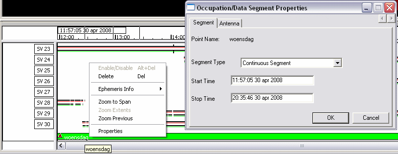
Figure, right click at the blue bar which is totally bar, it wil turn into a green colour.
-process baselines
Process
Process GPS baselines
Save
-export
Pt, N, E, E, Code
Custom
Make a new format, click on edit format
Ocean Mapping Group format
Made by Auke, Arctic Strathcona Sound August 2008
Hour, minute, second, day, month year, latitude, longitude, height.
Format body:
[Point Obs.Time:<H mm ss>:utc] [Point Obs.Time:<dd MM yyyy>:utc>] [Latitude:13.9:+d.dd] [Longitude:13.9:+d.dd] [Elevation] [$System.Replace<°><>]
- OMGdataformat
- either select whole data base, or make sure you select all the data in the geographical window (left click drag)
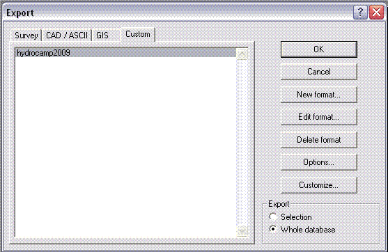
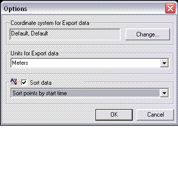
-go to options, click sort data, and select sort points by start time
-Ok
Auke/processed/29april2008
29april 2008
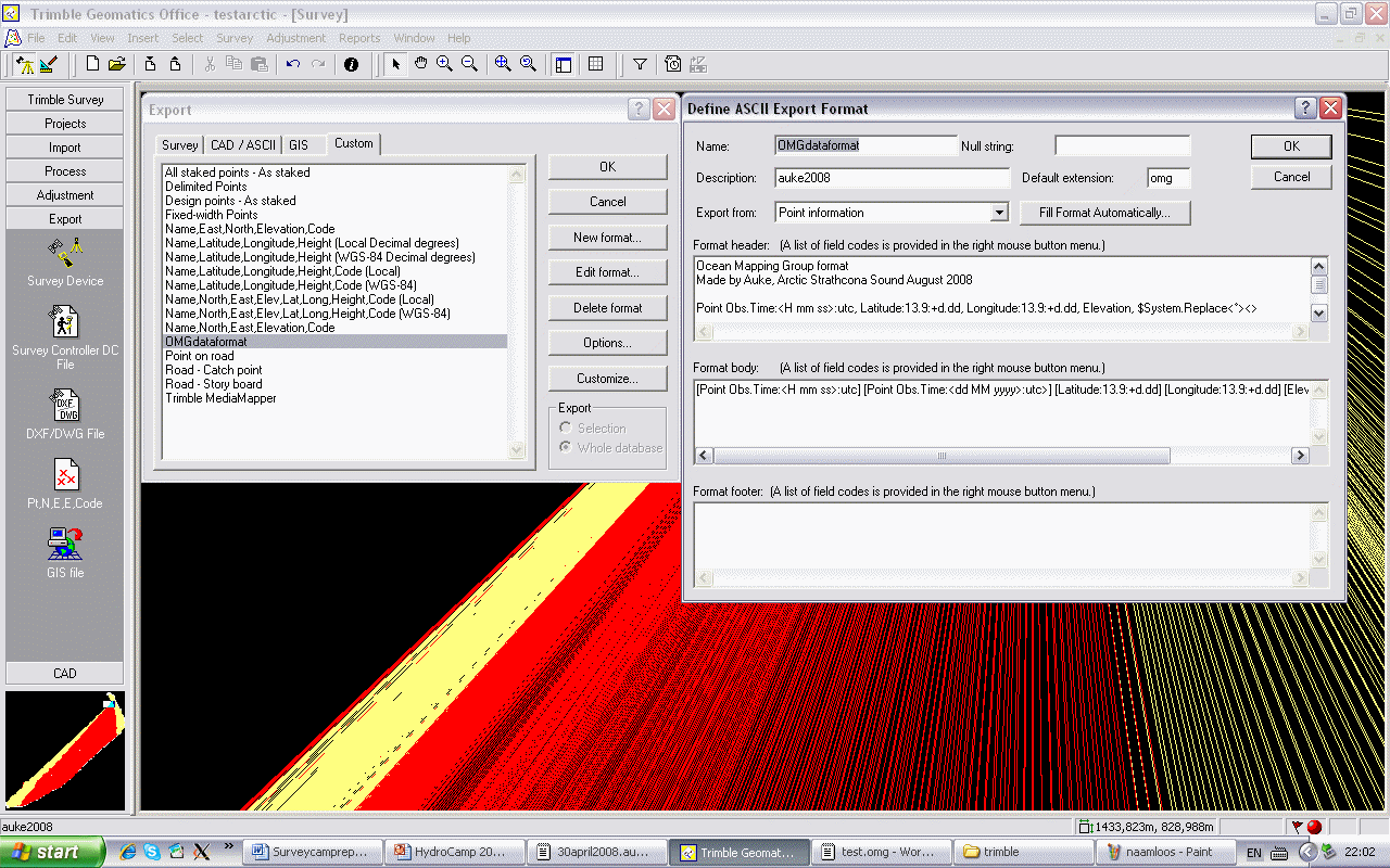
Figure, export your own format
2. Process in OMG (in Linux)
1. AuketoNav -comp march09.nav march09.auke
2. Apply_PPK JD*** 0016_20090326_144310
Now it will dump some plots.

4. grid JD085 0016_20090326_144310
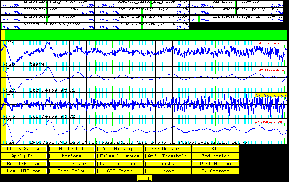
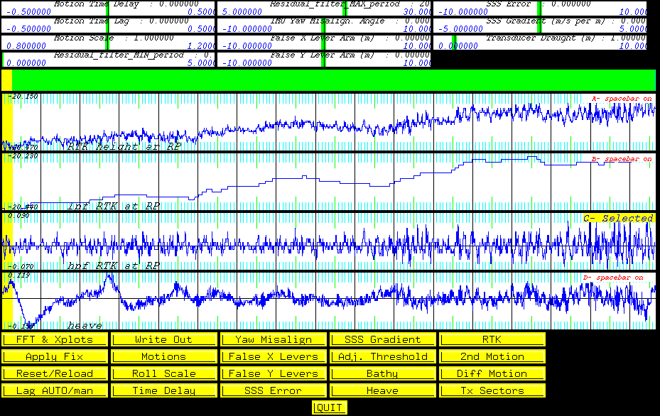
Now it will dump some more plots
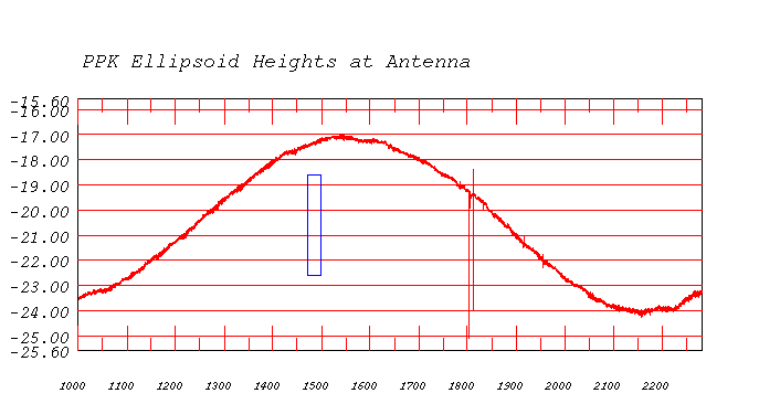
Long period heave taken out
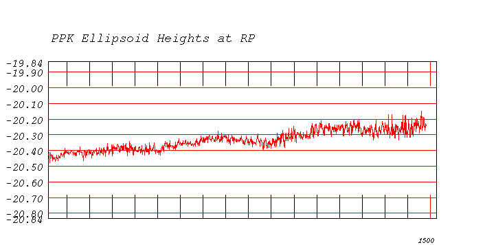
tide trend + long period heave taken out
long period RTK which is the same as the Filtered PPK Ellipsoid Heights at RP plot