|
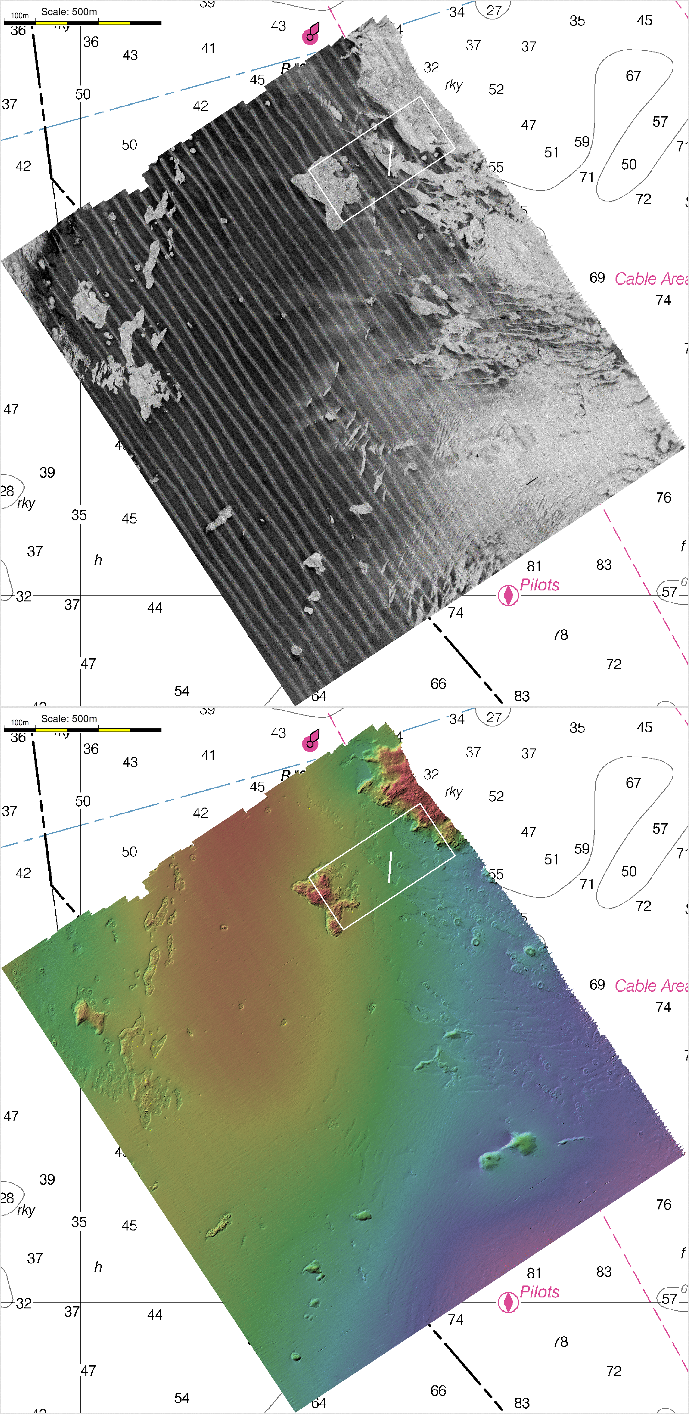
Location of Dive Site
|
Animation Showing Backscatter and
Bathymetry - 850m x 400m area
Nov 2021 - Jan 2022 - Mar 2022 (0.5m resolution) 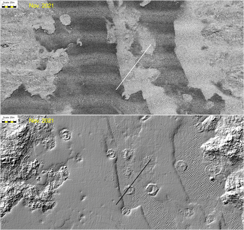 |
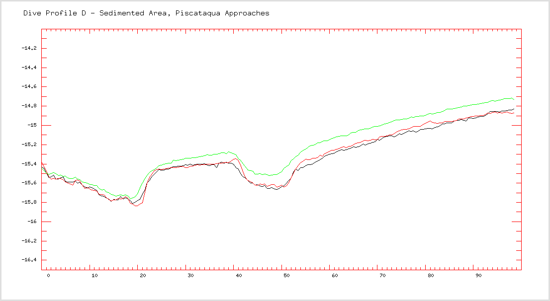
| Comments: Perceived acoustic characteristics and suspected sedimentary facies. This crosses the sharp boundary from the sand sheets to the gravel ripples. It also crosses over two of those (suspected) dredge spoil dump rings. |
|
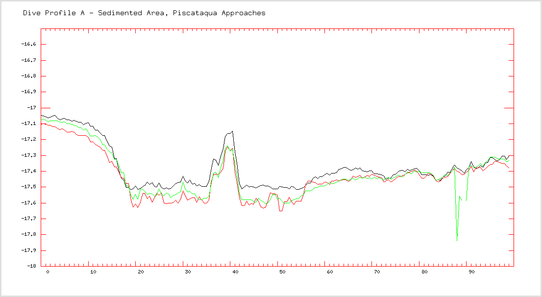 100 m long bathymetric profile along dive transect (vertical scale 2.5m) |
|
|
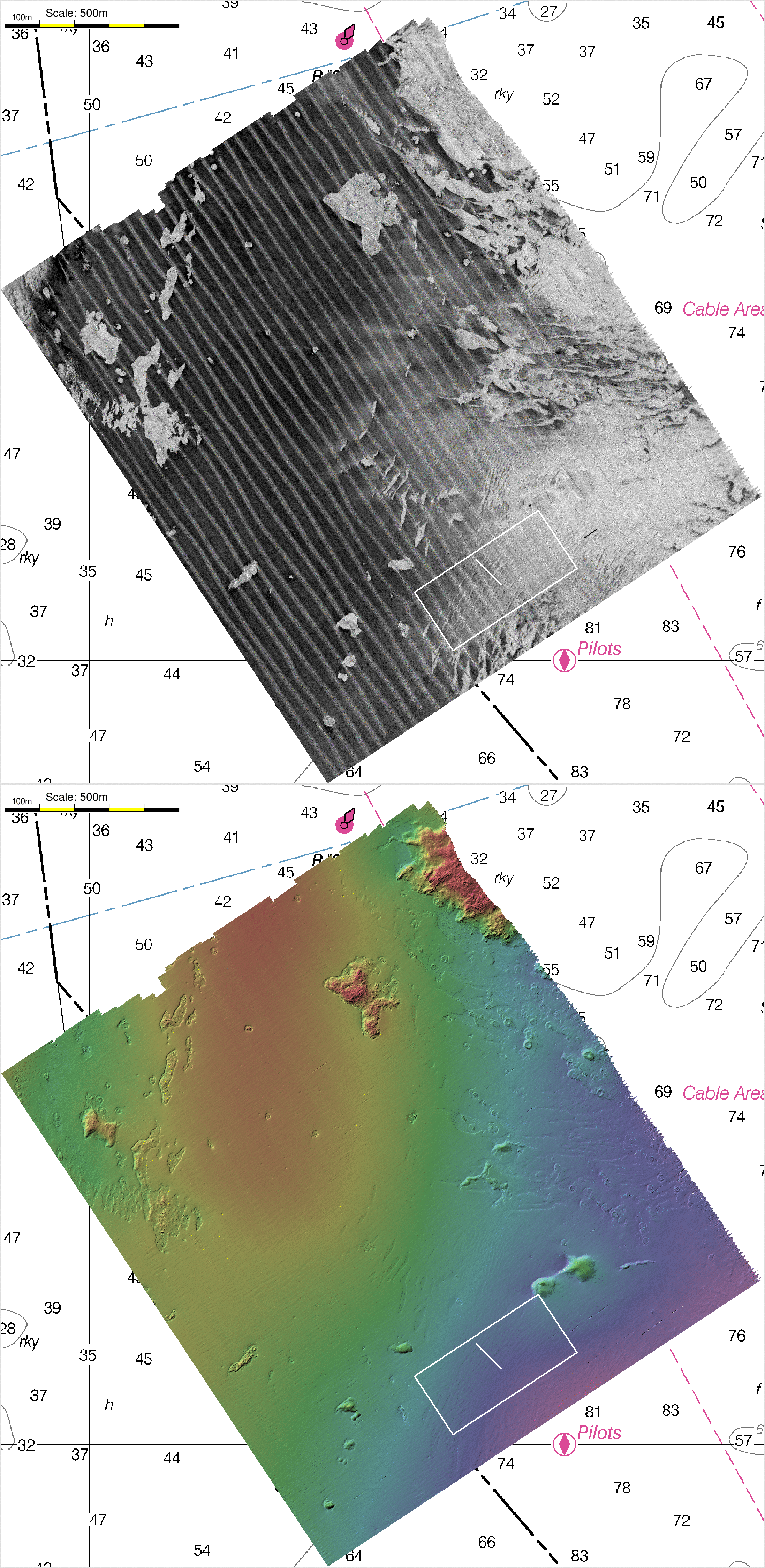
Location of Dive Site
|
Animation Showing Backscatter and
Bathymetry - 850m x 400m area
Nov 2021 - Jan 2022 - Mar 2022 (0.5m resolution) 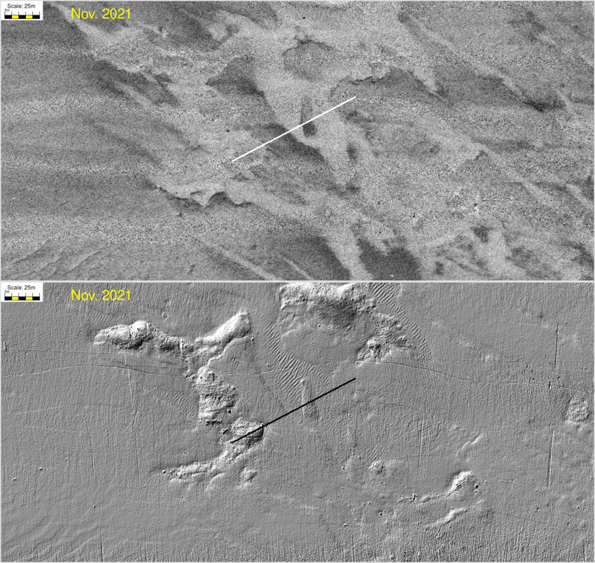 |
| Comments: Perceived acoustic characteristics and suspected sedimentary facies. Starting on one of the (suspected) deflated moraine ridges, it crosses a variety if intermediate backscatter signatures - notably there appears to be gradient in the center sand belt.And then it goes over gravel ripples, in the middle of which there is an anomalous low backscatter positive knoll. |
|
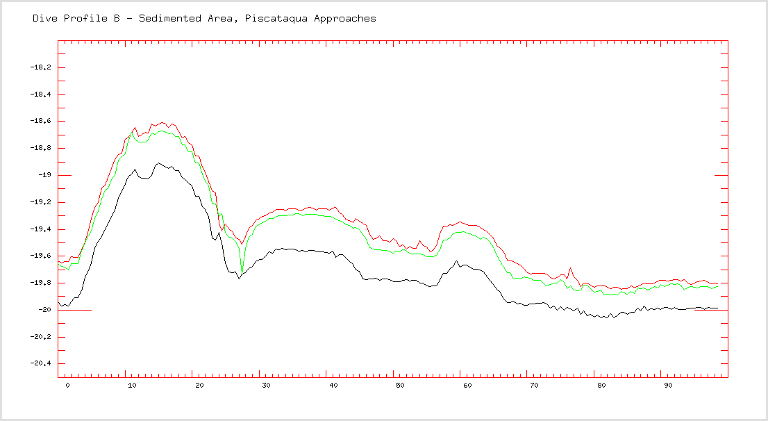 100 m long bathymetric profile along dive transect (vertical scale 2.5m) |
|
|
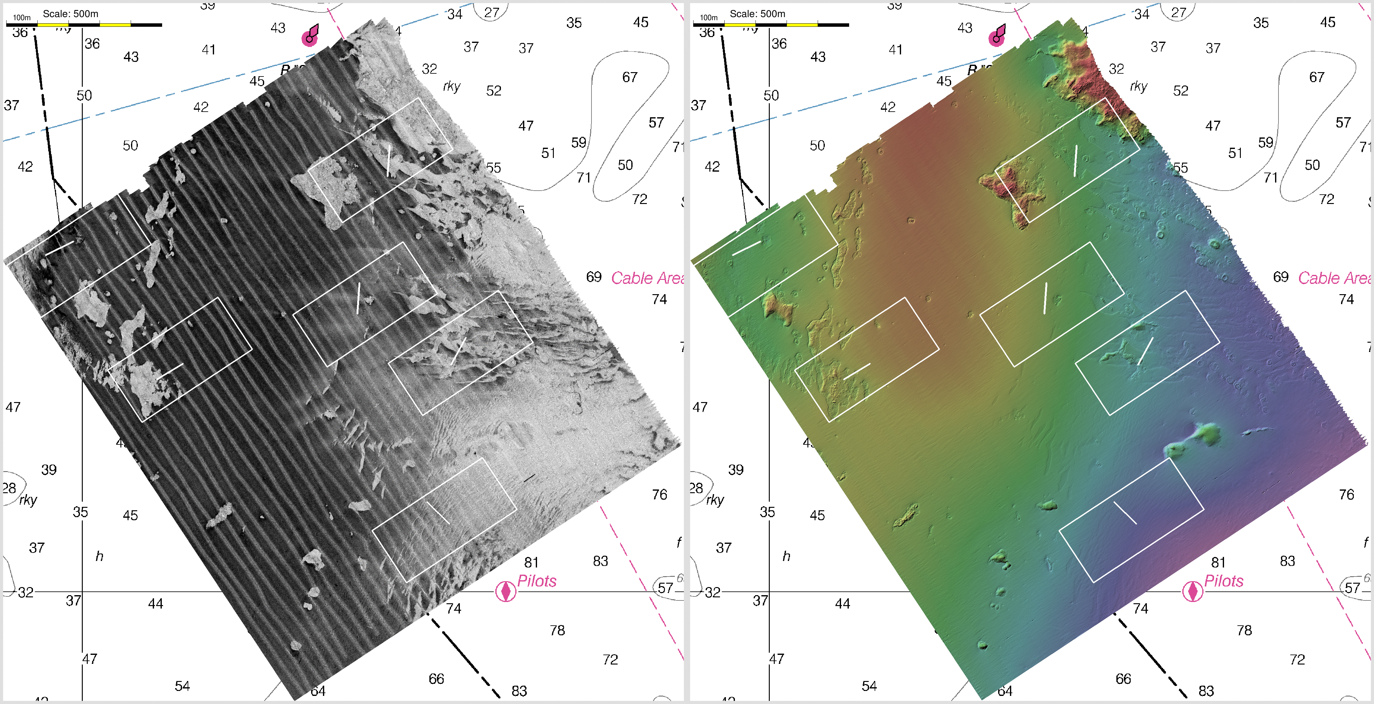
Location of Dive Site
|
Animation Showing Backscatter and
Bathymetry - 850m x 400m area
Nov 2021 - Jan 2022 - Mar 2022 (0.5m resolution)  |
| Comments: Perceived acoustic characteristics and suspected sedimentary facies. This is located at the eastern inshore-most corner of the area. It is where an anomalous low backscatter (and corresponding rough bathymetry) that appears and dissapears from survey to survey. |
|
 100 m long bathymetric profile along dive transect (vertical scale 2.5m) |
|
|
Location of Dive Site
|
Animation Showing Backscatter and
Bathymetry - 850m x 400m area
Nov 2021 - Jan 2022 - Mar 2022 (0.5m resolution) 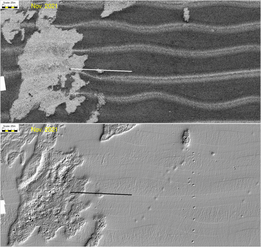 |
| Comments: Perceived acoustic characteristics and suspected sedimentary facies. This transect deliberately runs from the boulder terrain, across the sharp (and migrating) edge of the sand sheet. And that sand sheet sometimes shows a strong variability in the shape of the near-normal incidence angular response. It is present in some surveys and absent in others (most in November, least in March). It tends to have a sharper specular echo as it approaches the boundary between the sand and the boulders. The transect runs over a local depression, dipping down to the underlying boulder lag that significantly changes its dimensions from survey to survey. |
|
 100 m long bathymetric profile along dive transect (vertical scale 2.5m) |
|
|
Location of Dive Site
|
Animation Showing Backscatter and
Bathymetry - 850m x 400m area
Nov 2021 - Jan 2022 - Mar 2022 (0.5m resolution) 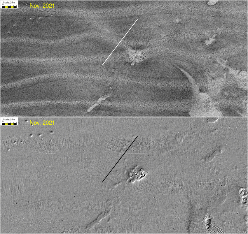 |
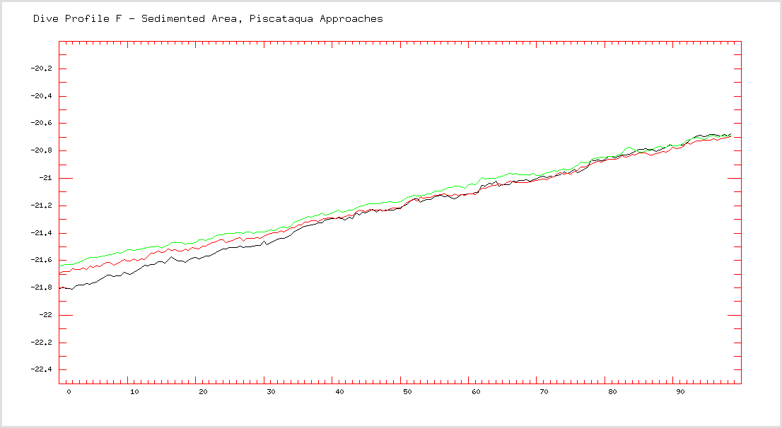
| Comments: Perceived acoustic characteristics and suspected sedimentary facies. This transect is all in the smooth (presumably sand sheet) area. But it crosses over one of those higher backscatter "tails" that extend due west from many of the boulder piles (and exhibits no discernible bathymetric relief). I'm assuming that this is some relict of the storm driven movement of the sand to the west. |
|
 100 m long bathymetric profile along dive transect (vertical scale 2.5m) |
|
|
Location of Dive Site
|
Animation Showing Backscatter and
Bathymetry - 850m x 400m area
Nov 2021 - Jan 2022 - Mar 2022 (0.5m resolution) 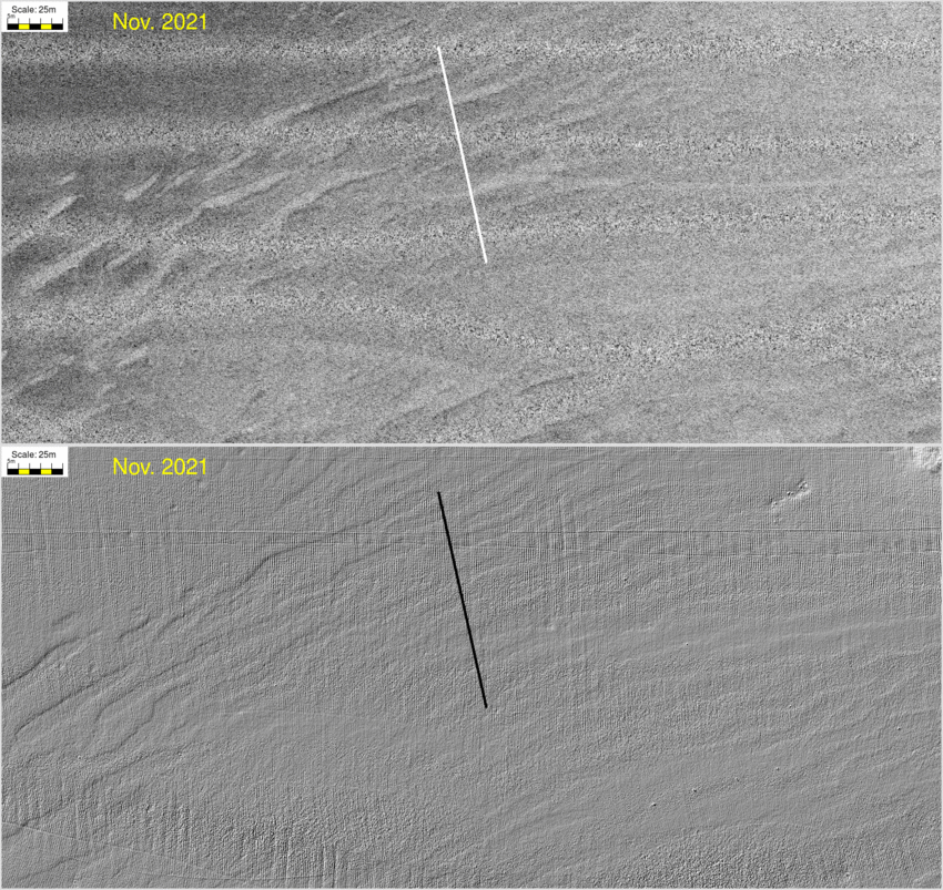 |
| Comments: Perceived acoustic characteristics and suspected sedimentary facies. This transect cuts orthogonally across those bands of high and medium backscatter. The contrast varies with time of year. At some times of the year, they exhibit an "eye liner" of low backscatter facies. The high backscatter is in a slightly deeper depression. |
|
 100 m long bathymetric profile along dive transect (vertical scale 2.5m) |
|